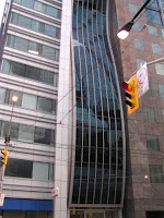
The second half of my look at the great city of Toronto will be broken down into individual neighborhoods. Most of these will be in the downtown core, but all will be within the traditional boundaries of the city as opposed to the amalgamated suburbs. A quick disclaimer, the photos are mine and are not intended to be exact matches for the neighborhoods described. Most are of the College Park area or Front Street.
Just to the north of the University of Toronto, the Annex is a largely residential Victorian, Georgian, and Tudor district anchored by Bloor Street on the south end. The area is home to the Toronto landmark Honest Ed's and is easily accesible from multiple stops on the Bloor-Danforth subway line. The old village of Yorkville, technically part of the annex (at least as defined by municipal government), has become an exclusive shopping district serves as a bridge to Rosedale, home of the 'old money' and houses the Royal Ontario Museum.
Directly to the east of downtown, Cabbage is a neighborhood seeing great gentrification. A heritage conservation area, it retains the character of a less-expensive era and attracts businesses being priced out of midtown. Bordering on the Allan Gardens park and botanical garden, the spine of Cabbagetown is easily accessable on the 506 streetcar.
West of the new Toronto City Hall plaza, on roughly the same axis as Cabbagetown is one of the largest Chinatowns in North America. No explanation necessary. Also in this area is the Kensington Market meat, produce, bread, and cheese cluster.
At the intersection of Mill Street and Trinity southeast of downtown lies the gates of the former Gooderham and Worts Distillery. Now a pedestrian oriented arts and entertainment neighborhood, the Distillery District boasts the largest collection of Victorian age industrial architecture in North America. Closest streetcar service is provided by the 504 King.
Billed as the world's longest street, Yonge is the major north-south axis of the city. The original subway line travels under the street, creating mini downtowns at each major subway stop. Almost anything you can think of is available on Yonge Street and it is likely your hotel would only be a block from it at most. Theatres, Shopping, Restaurants, and Activities line the route through the entirety of what is considered downtown Toronto.
The rest of the theatres offering long running productions at national quality reside here, just west of the financial district. Major league sporting venues and companion restaurants flank improv clubs like Second City near all major transport at Union Station.
Not an official neighborhood as far as I can tell, the grounds of Exhibition Place are host to the annual Canadian National Exhibition (think state fair on a national scale). A restored coliseum is home to a minor league hockey team, a new grandstand was recently built for a major soccer team, the Ontario Place amusement park is located on an island in Lake Ontario, and a restored Fort York is just off the grounds. Exhibition is the western terminus of the 509 streetcar from Union Station.
Quickly filling up with high-rise condos, the Harbourfront area is best appreciated in summer when one can take a boat tour or a ferry to the Toronto Islands that protect the harbor. More unique shopping opportunities exist in converted dockside terminal buildings. The Harbourfront area features enhanced streetcar service with underground stations that link to Union Station.
Now home to its namesake, the St. Lawrence Market where one can realize all the benefits of farm vendors on saturday mornings, the St. Lawrence neighborhood was the actual downtown center throughout the 18th and 19th centuries (what is now the south market building once housed city council chambers). I had planned on pontificating about the correct way to integrate subsidized housing at this point even though it is not in the spirit of a neighborhood rundown, but instead I'll quote this eloquent paragraph from the Wikipedia entry on St. Lawrence:
"In the 1970s it was decided by mayor David Crombie to turn the area into a new residential neighbourhood, but one that would not make the same mistakes of the housing projects of earlier decades. The neighbourhood was to be integrated into the city with no clear boundaries. It would contain a mix of commercial and residential as with both subsidized and market oriented housing, mostly rowhouse or low-rise apartments. The neighbourhood was planned by Alan Littlewood and the influence of American urban planner Jane Jacobs played a crucial role. Many of the developments were not completed until well into the 1990s. Since that time, the St. Lawrence neighbourhood has been critically acclaimed as a major success in urban planning. In many ways, it has become the model for the design and planning of new urban communities across North America."
The preceding paragraph and some short investigation into David Crombie's history imply that Toronto had reached a sort of turning point with respect to preservation and urban emphasis. Many landmarks, including Old City Hall were wisely spared. However in Toronto cranes and high-rise towers equal 'growth' and I've often noticed how areas have a different feel across six month to one year timeframes. To finish, I still have to laud the emphasis on transit, walkability, and respect of the public realm that Toronto projects to the visitor and hopefully to other North American cities as a living, breathing example of excellent urbanism on any scale.


1 comment:
Bob.
Glad to see this since I'm going up there in a couple of weeks for the first time in about 15 years. I'm looking forward to being able to walk around a real city that still feels that downtown is important, rather than the donut that Rochester has become after 5 PM and on most weekends.
Post a Comment